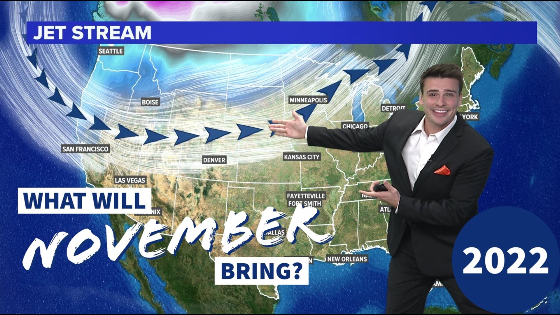
ARKANSAS, USA — November is here, but how cold will it get? Siberia and the Arctic Circle are cooling down with their ice and snowpack quickly growing thanks to longer nights. Air in these place will become colder and denser, helping it to move south toward the U.S. What can we expect?
Tap HERE to track snow/rain across the United States.
Much of the nation will start to have average highs go from the 60s to the 40s/50s in November. Plus, many states will have a higher chance to receive their first snowfalls. Winter weather is moving south.
DAYLIGHT
The main driver for the colder air is the loss of daylight for the northern hemisphere. The atmosphere loses more heat at night than it gains during the day. When the far north gets really cold, it starts to send drastic cold fronts south. How much daylight you lose is dependent on your latitude.

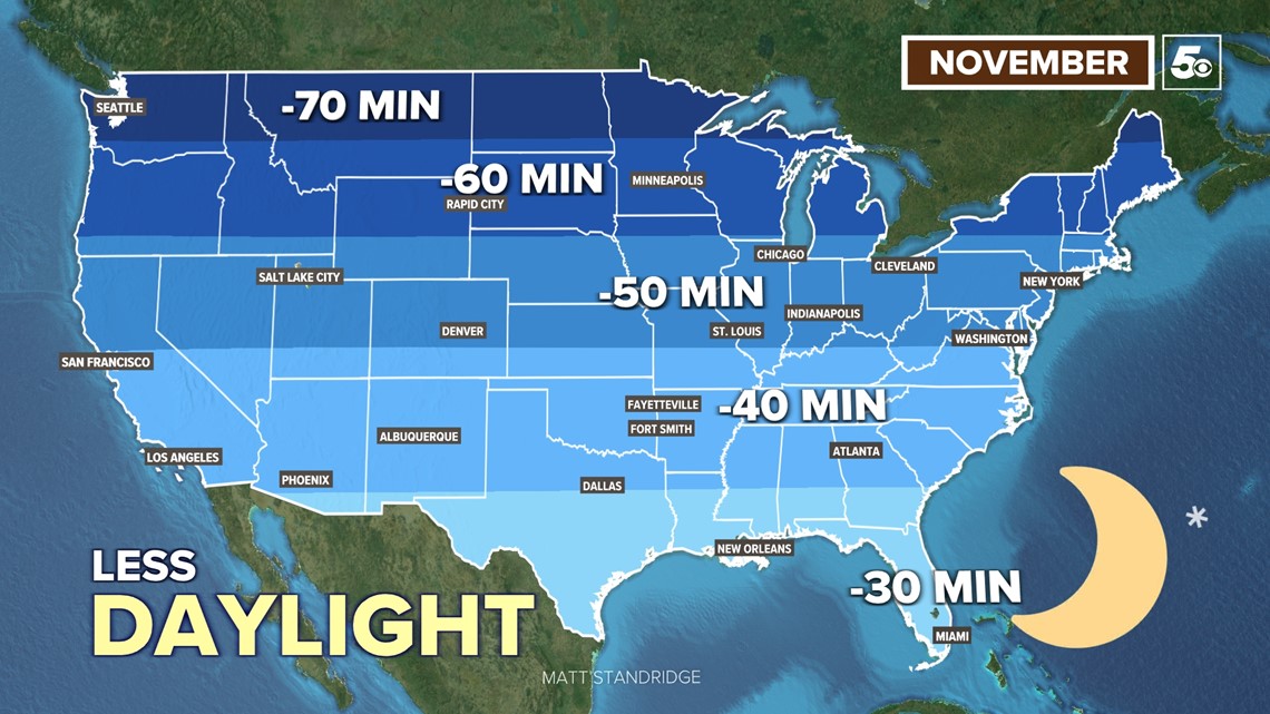
The zones show much daylight you will AT LEAST lose. Much of the United States will lose 40-60 minutes of daylight by November 30th. November is the last full month with daylight loss. We actually start to gain it back just before Christmas (winter solstice -- December 21, 2022).
JET STREAM
To track how far south storm systems go and the cold air reaches, we track and forecast the position of the jet stream, the channel of air that separates large masses of cold air from warm air.

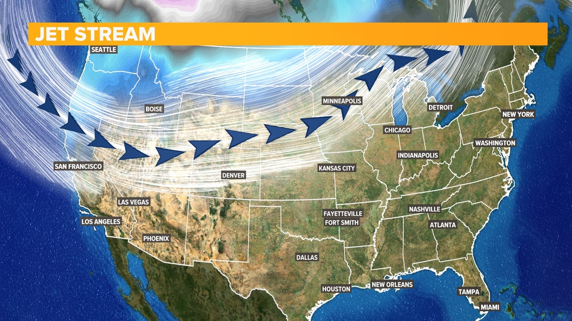
The biggest dips in the jet stream will be in the western U.S. This will help bring more mountain snow and valley rain to the west. We'll track storm systems coming out of the Rockies, making a journey northeast toward the Great Lakes. Sometimes they will come far enough south to the Ozarks.
TEMPERATURE | 2022 OUTLOOK
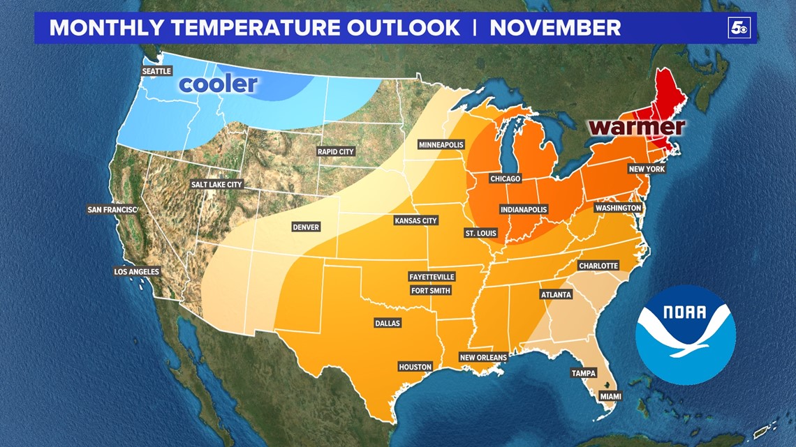
With more frequent jet stream dips in the west, expect cooler-than-normal conditions in the Pacific Northwest. For much of the central and eastern U.S., fewer jet stream dips will mean warmer-than-normal temperatures. There will still be chilly, dreary days in the east, but there will likely be more warm days than cold days.

PRECIPITATION | 2022 Outlook
The jet stream will be the most active back west. However there will be shortwaves that move east out of the Rockies and swing northeast. Some of these may dip as far south as the Ozarks and central Plains. The areas mentioned can expect more rain (and snowfall in higher elevations). Drier than normal conditions expected along the Gulf Coast and eastern seaboard.

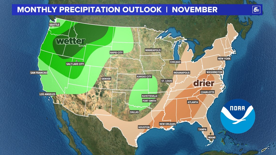
ARKANSAS AND OKLAHOMA
Overall we are expecting slightly warmer and slightly wetter conditions. However what does that mean?
We are expecting more 60s than 50s across the south-central U.S. with a 4-6 inches of rain for the month. On average we get 3-4 inches. Average conditions:

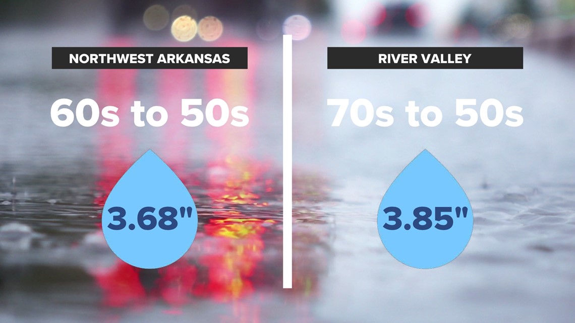
November typically brings the first flurries to Arkansas. However with warmer than normal weather, this chance of snow will be lower. Flurry chances may have to wait until December, and for southern Arkansas maybe January.
-5NEWS Chief Meteorologist Matt Standridge

