FAYETTEVILLE, Ark. — As the chill in the air sets the stage for winter, our weather team has been hard at work preparing this year’s Winter Weather Outlook. Crafting these forecasts is a complex process, influenced by global weather patterns, historical data, and long-range computer models.
The Winter Outlook Process
Developing a seasonal outlook is part science and part detective work. Here’s how we pieced it all together:
- We monitor sea surface temperatures in the Pacific and analyze jet stream patterns. During a La Niña winter, the jet stream often shifts farther north. The jet stream is our "storm track," so when this gets displaced, we notice!
- Advanced computer models simulate how the atmosphere might respond to La Niña conditions. These models incorporate data on ocean temperatures, wind patterns, and even soil moisture levels.
- We compare current conditions to previous La Niña winters. We call these analogs. Sometimes the best way to predict the future is to look to the past.
- Global weather trends are helpful, but every region reacts differently. We factor in local terrain and elevation to tailor the forecast to Northwest Arkansas and the River Valley.
What's Average Around Here?
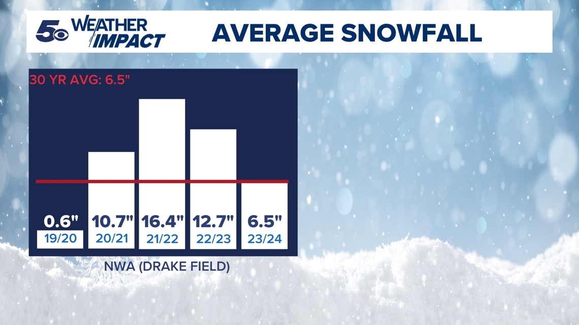
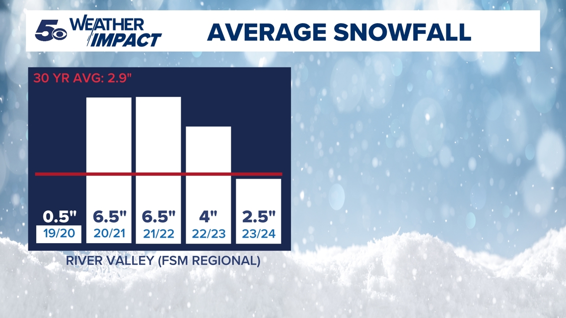
Our baseline is a 30-year average. We use Fayetteville's Drake Field as our data point for Northwest Arkansas and Fort Smith Regional Airport for the River Valley.
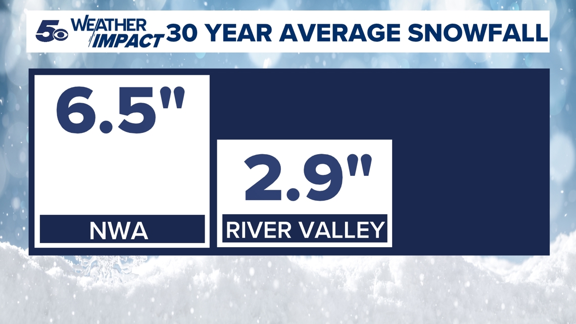
On average, Northwest Arkansas measures 6.5" of snow per winter, while the River Valley average is 2.9".

Recent Years Have Been Good for Snow Lovers
In the last four out of five winters, Northwest Arkansas has recorded above average snowfall. In some cases, well above average! In the River Valley, three out of the last five winters have been above average, with last year falling just slightly below.
Northwest Arkansas

River Valley

Looking Ahead
What is La Niña?
One of the key drivers in this year’s outlook is a familiar climate phenomenon: La Niña.
La Niña is part of the larger El Niño-Southern Oscillation (ENSO) cycle, which occurs in the Pacific Ocean. During a La Niña phase, cooler-than-average sea surface temperatures develop in the central and eastern equatorial Pacific. This subtle cooling can disrupt atmospheric circulation patterns and ripple through the global climate system.
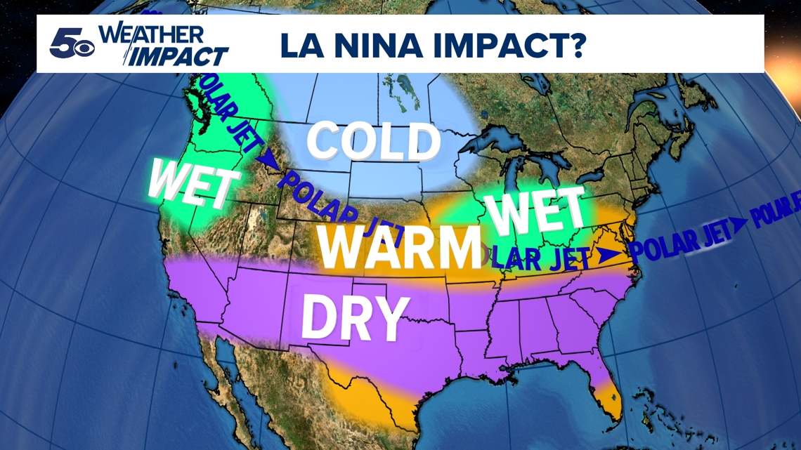
For us here in Arkansas and eastern Oklahoma, La Niña is a critical factor in determining how our winter may unfold. Historically, La Niña winters have been associated with:
- Cooler and wetter conditions in the northern United States.
- Warmer and drier conditions in the southern United States.
- Increased potential for extreme weather swings, such as sudden snowstorms or prolonged dry periods.

Is This Year A Normal La Niña?
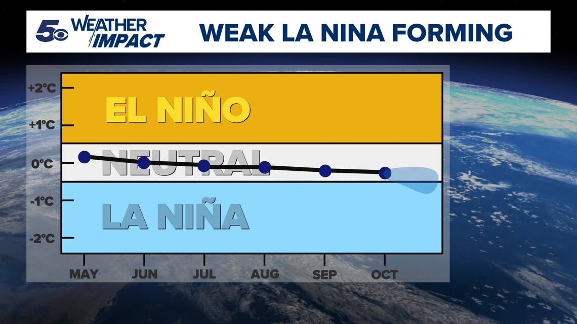
In short, no. First, no two La Niñas are ever the same. This year's La Niña has been very slow to develop. In fact, as of right now, it's still not officially developed. Though, forecasters at NOAA's Climate Prediction Center (CPC) give it a 57% chance of developing in the next two months as waters along the equator continue to slowly cool.
Given the later than normal onset and overall lower magnitude, this La Niña may not pack as much of a punch, though some subtle influence is likely.

Analog Years
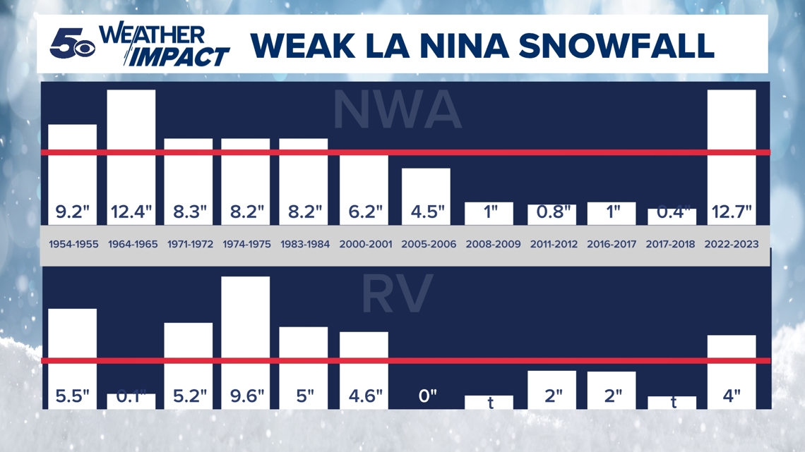
To better understand what a weak La Niña may mean for us this year, we look to past years. These similar "setups" can sometimes give clues to how things will play out.
Looking back as far as the 1950s, it's somewhat of a mixed bag. In both Northwest Arkansas and the River Valley, there were definitely some years where we over performed, while other years we barely recorded any measurable snow. A true feast or famine!

2024-2025 Prediction
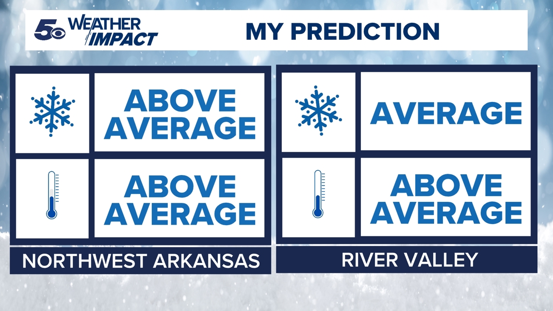
Given the trend of above-average snowfall in recent years and a weak La Niña, I think there's reason to believe we see above average snowfall in Northwest Arkansas and near-average in the River Valley.
When it comes to our temperatures, I believe when it's all said and done, many of us will have above-average temperatures. But wait, you said more snow! How could the temperatures be above normal?
We'll likely see cold snaps. Arctic air will spill down into Arkansas and Oklahoma. This is a safe bet. But, these cold spells are likely to be short-lived. Temperatures will likely rebound quickly, and well above normal. At the end of winter, the average will likely be above normal as a result.
Bold Prediction: I wouldn't be surprised if we don't see a system or two that brings severe weather and winter weather in the same day.

