
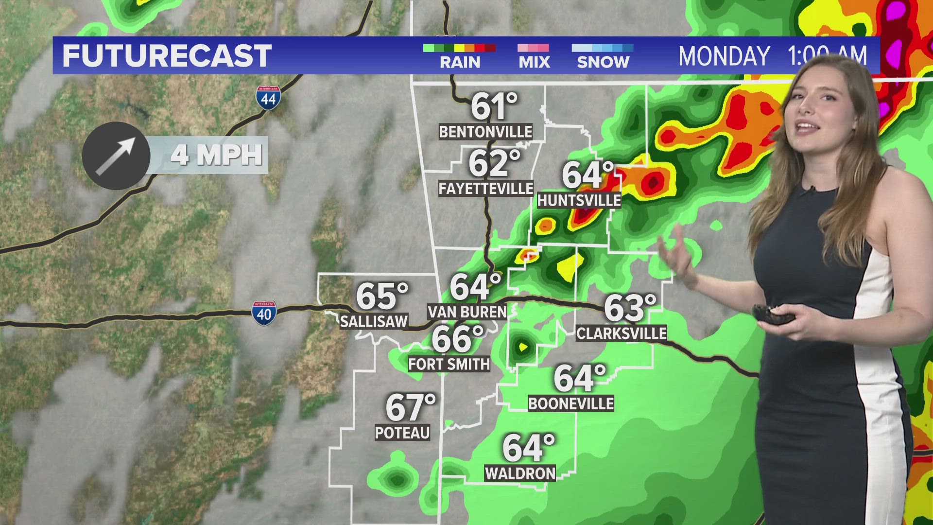
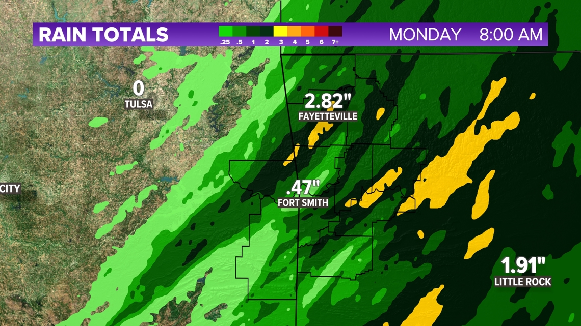
FAYETTEVILLE, Ark. — Scattered thunderstorms rolled through Arkansas and Oklahoma all evening, but things are starting to calm overnight. However, flooding is a lingering threat across 5COUNTRY. Standing water and flooding is likely across areas of lower elevation in both Northwest Arkansas as well as the River Valley. Heavy clouds will linger into Monday morning.
Tap HERE to check our interactive weather radar.
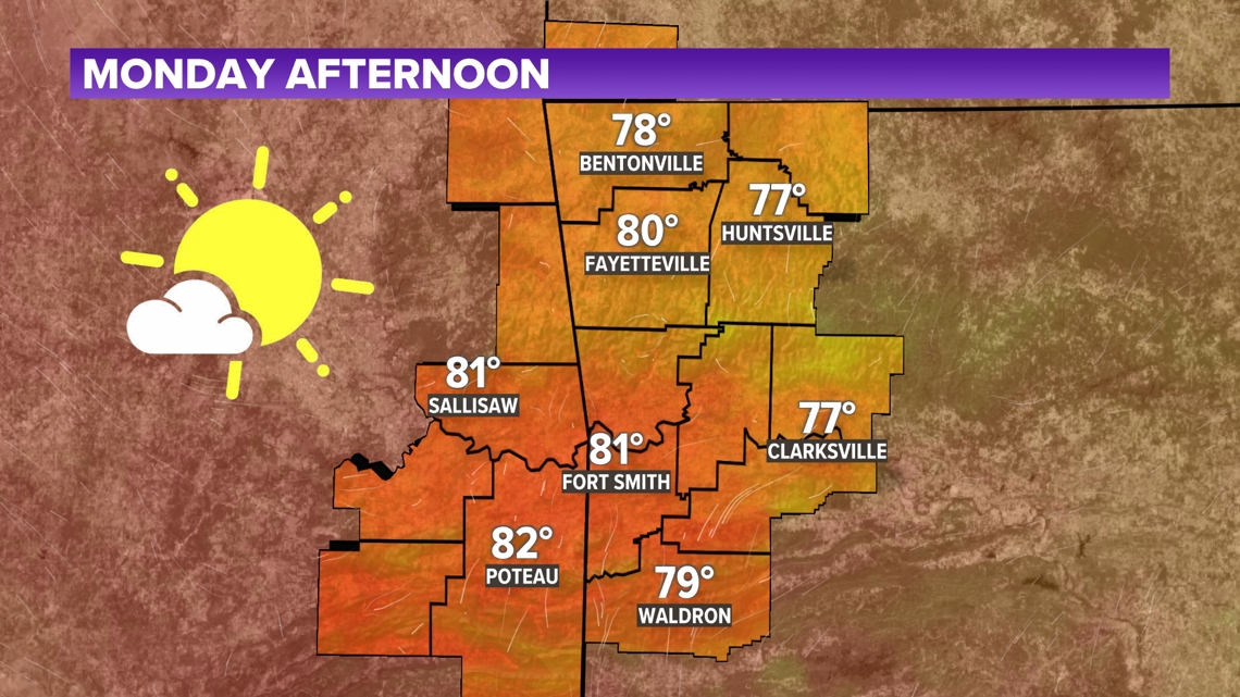
The sun will come out tomorrow... afternoon. We are looking at a gorgeous Monday with highs in the high 70s and 80s and winds staying below 10 mph. Sunshine takes over the afternoon to dry out any remaining puddles. Warm and sunny days will stick around over the start of the week, but rain chances are inching up for the late week.
TONIGHT
- Showers decreasing | 70%
- Lows in the 50s/60s
- Decreasing west winds | Gusts: 20 mph
MONDAY
- Overcast AM then sunshine
- Highs in the 70s/80s
- Variable winds 5 to 10 mph


WARM AND SUNNY STRETCH BEFORE RAIN RETURNS
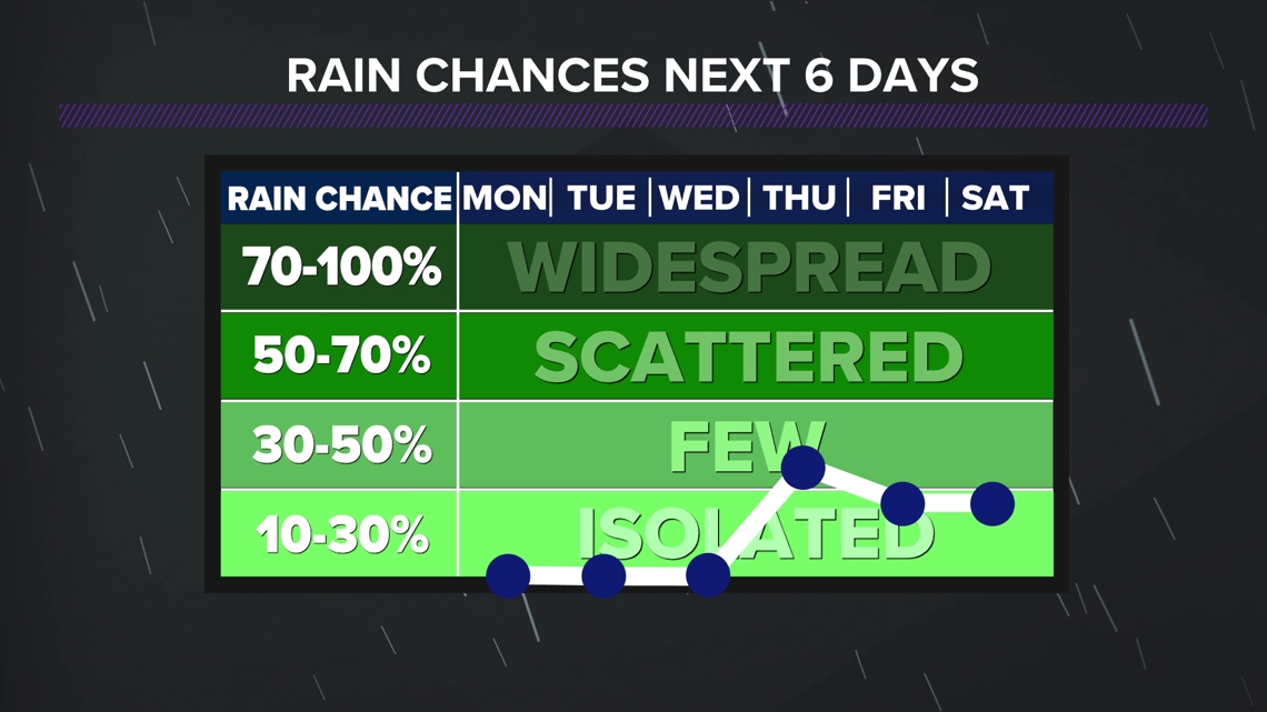
Clear skies are taking over early this week after a long weekend of storms. High pressure is rolling in from Texas and keeping skies dry for the first half of the week. It's not until later this week that rain chances work their way back into the forecast. Showers are expected to pick up over Wednesday night and continue through Friday.

- Bella Grace
Watch 5NEWS on YouTube.
Download the 5NEWS app on your smartphone:
Stream 5NEWS 24/7 on the 5+ app: How to watch the 5+ app on your streaming device
To report a typo or grammatical error, please email KFSMDigitalTeam@tegna.com and detail which story you're referring to.