
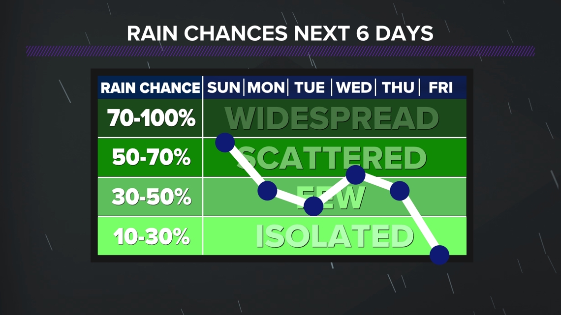
FAYETTEVILLE, Ark. — Multiple rain chances through the rest of the weekend and into the start of the week. We have picked up a lot of rainfall to end April and start May, so right now our soil is very saturated. This is going to lead to some flooding concerns, as we have a flood watch across 5COUNTRY. Strong to severe storms will be possible through Wednesday.
Tap HERE to check our interactive weather radar.
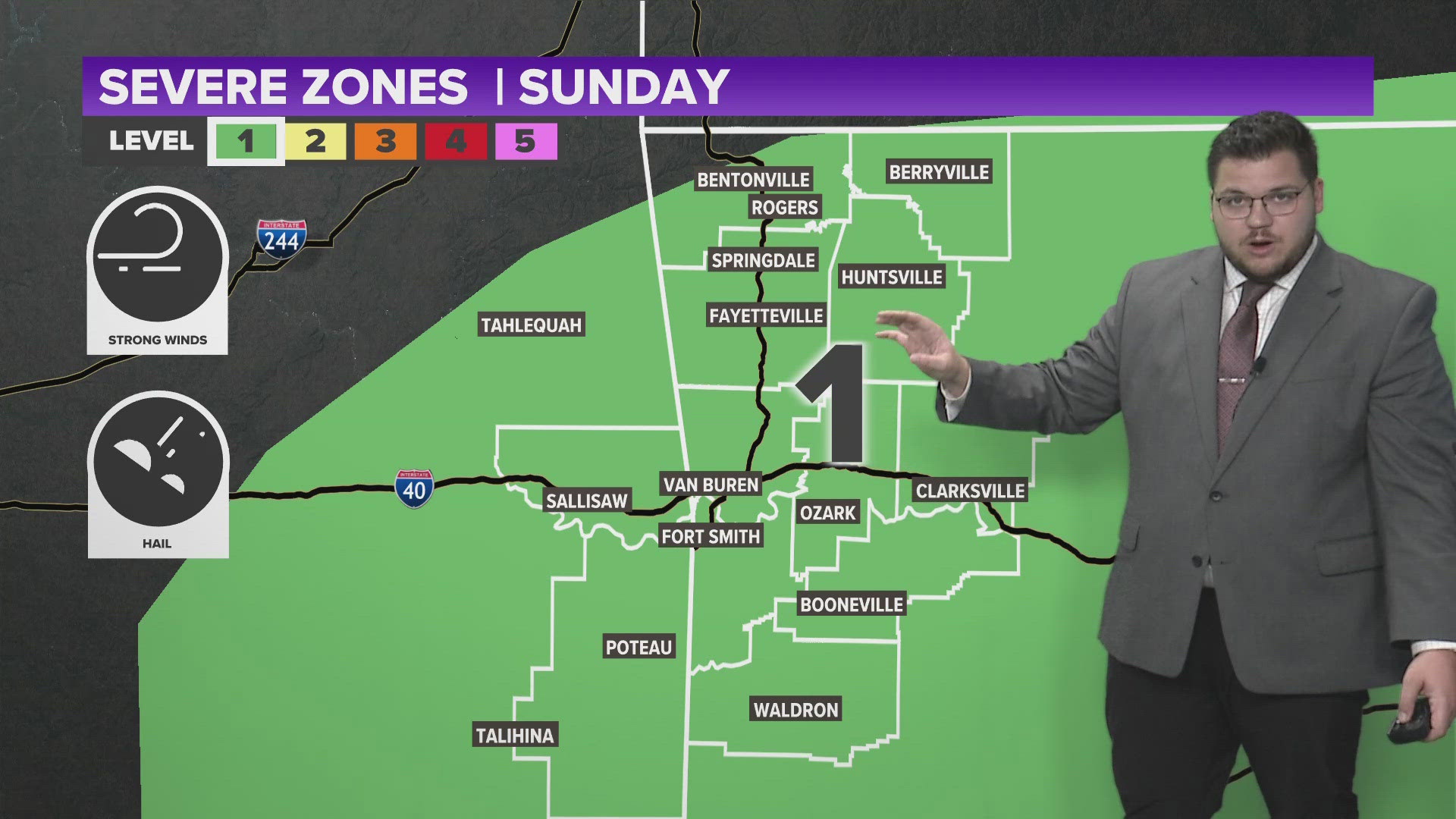
Several outlooks have been issued from the Storm Prediction Center. Through the rest of the weekend expect strong storms that should stay below to the severe limit for the most part. As we get into the work week, strong to severe storms will be possible. We finally drop out of this active pattern by the end of this week.
TONIGHT
- Mostly cloudy
- Scattered showers and thunderstorms | 40%
- Lows in the 60s
- Northwestern winds becoming eastern 5 to 10 MPH
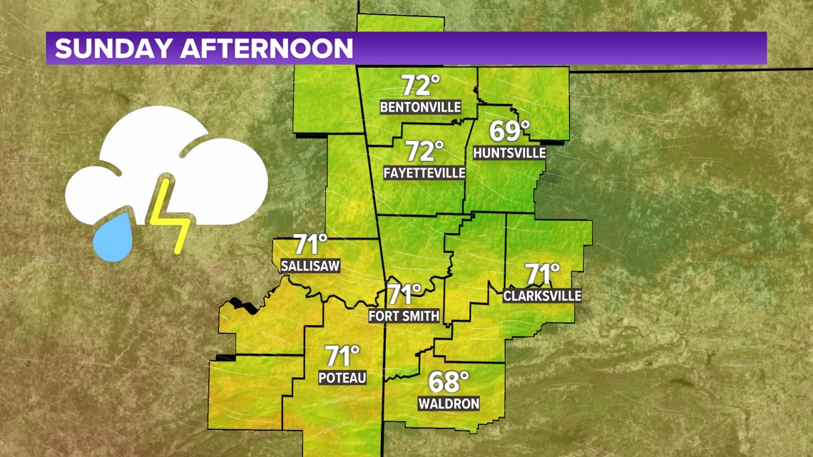
SUNDAY
- Scattered showers and thunderstorms | 80%
- Highs in the 70s/80s
- Southerly winds 5 to 10 MPH

ACTIVE PATTERN CONTINUES FOR THE NEXT SEVERAL DAYS
The Storm Prediction Center has placed outlooks for 5COUNTRY through Wednesday. We continue this active pattern where we will have several chances to see strong to severe thunderstorms. The main concern will be the chances to see flash flooding across the region as we have picked up a lot of water over the past few weeks. Strong winds, hail, and an isolated tornado threat will be available.

- Stephen
Watch 5NEWS on YouTube.
Download the 5NEWS app on your smartphone:
Stream 5NEWS 24/7 on the 5+ app: How to watch the 5+ app on your streaming device
To report a typo or grammatical error, please email KFSMDigitalTeam@tegna.com and detail which story you're referring to.