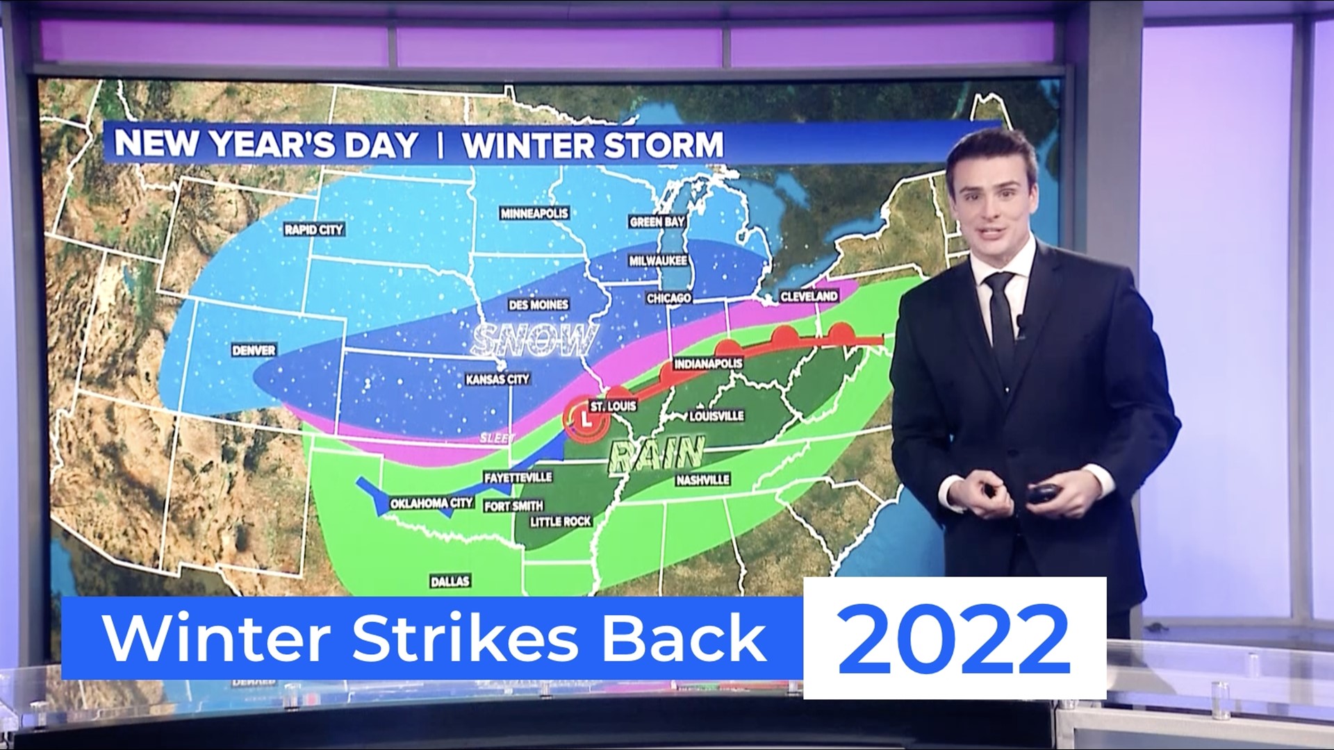
ARKANSAS, USA — After an unseasonably warm December, much colder air will create a winter storm for the central U.S. by January 1st, 2022. Rounds of record-breaking snows have hit the west, but now that atmospheric energy is charging west into the Plains, bringing a mix of rain, ice, and snow to the central United States. As soon as we ring in the new year Friday night, Saturday will turn into a mess for millions of Americans from the Rockies to the Great Lakes.
HIGHLIGHTS
- 6+ inches of snow likely across the Corn Belt
- 12+ inches of snow from Kansas City to western Illinois
- Heavy rain from Arkansas to Tennessee (1-3+ inches)
- Ice possible near I-44 in Missouri
OVERALL SETUP

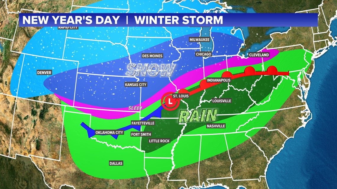
The center of lowest pressure helps dictate how far south cold air can go. Essentially north of the low pressure, you have the rain/ice/snow line. With the lowest pressure tracking from central Missouri into central Illinois, mainly rainy conditions are expected in the southern Ozarks to the Tennessee River Valley with a wintry mess northbound into the Corn Belt and Great Lakes.
SNOW ACCUMULATIONS

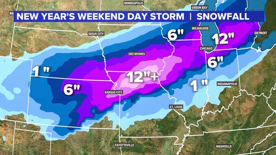
The highest snowfall is likely to stretch from Kansas to Michigan. Interstates like I-35, I-70 (west of St. Louis), I-80, and I-74 will likely have significant travel delays thanks to heavy snowfall.
RAINFALL ACCUMULATIONS

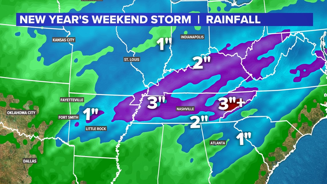
Scattered showers are possible for eastern Oklahoma and western Arkansas with under an inch of rain expected. Heavier rain is likely from Little Rock to Nashville, north to Louisville and Indianapolis. In stronger storms, some flash flooding will be possible.
SEVERE WEATHER
Strong-to-severe storms will be possible in the Deep South, especially in the Lower Mississippi River Valley. States like (eastern) Arkansas, Tennessee, Kentucky, Mississippi, Alabama, and Georgia will be on the lookout for gusty winds, hail, and some tornadoes. The biggest threat will be early Saturday morning and then Saturday afternoon with redeveloping storms.
MUCH COLDER BY SUNDAY

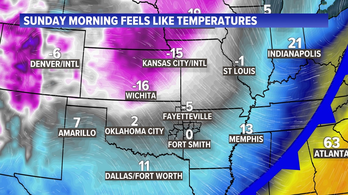
Temperatures will drop well below freezing for a majority of the Plains and Ozarks. Wind chills will drop below zero by Sunday more thanks to NW winds up to 25 MPH.
CLOSER LOOK AT SNOW CHANCES FOR ARKANSAS

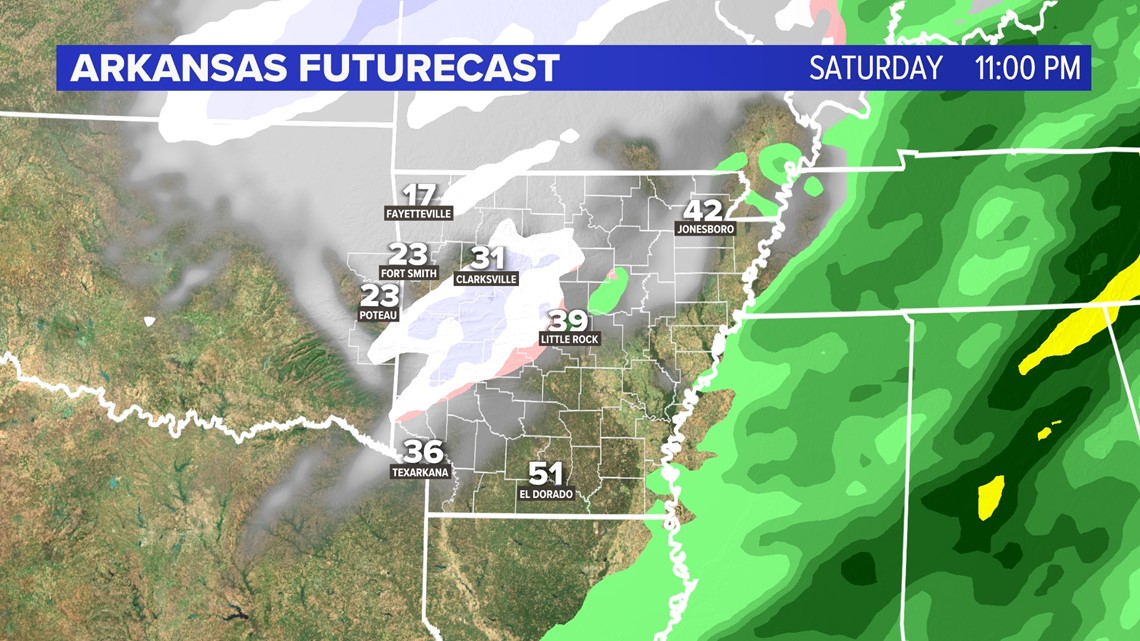
By Saturday evening, most of the precipitation will be gone, however lingering clouds and much colder temperatures may throw some snowflakes across parts of western Arkansas and eastern Oklahoma. Accumulations are not expected at this time. There may be some slick spots Saturday night into Sunday morning as wet roads freeze. Black ice may be an issue.
-5NEWS Weather

