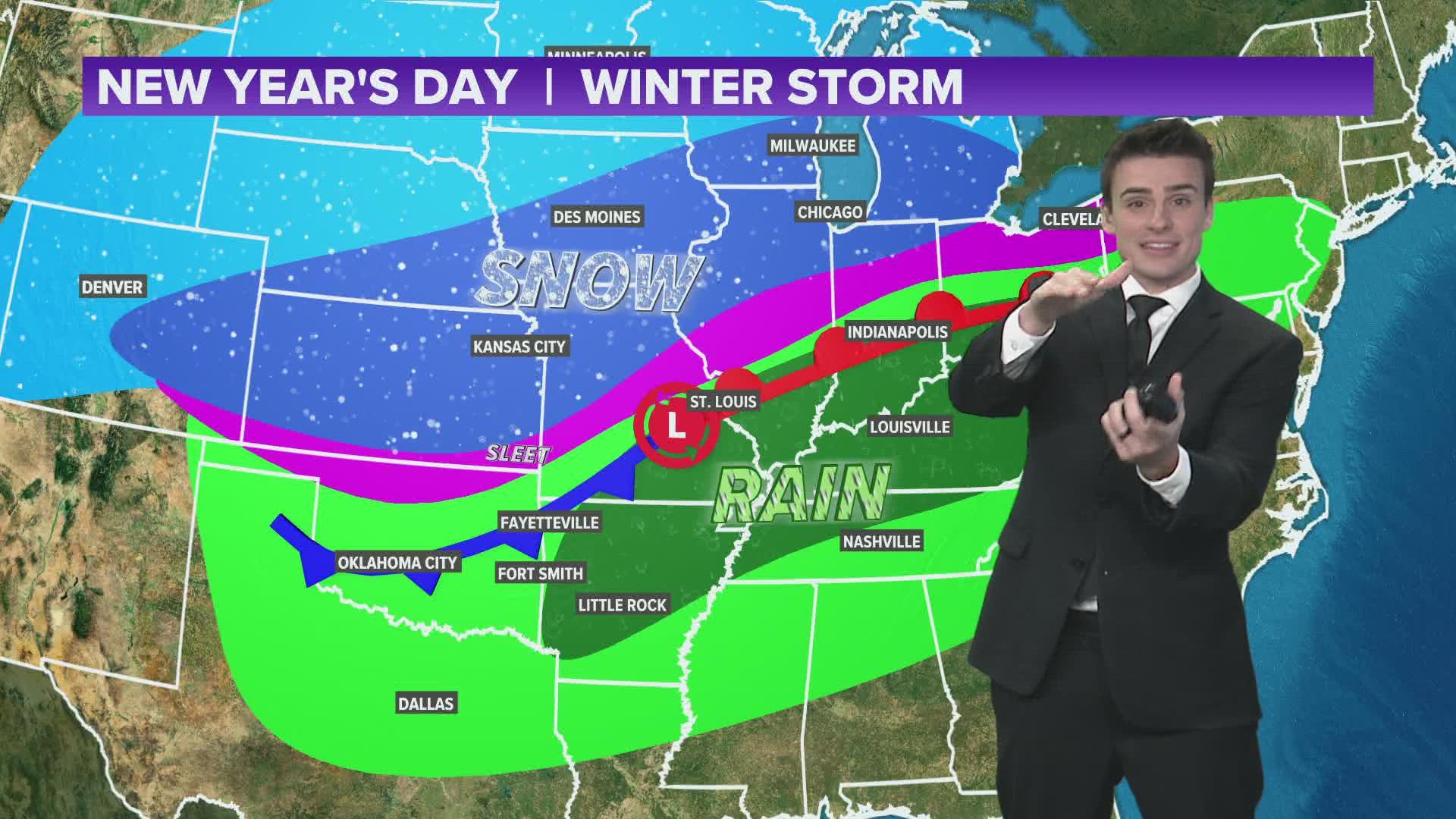
ARKANSAS, USA — 2022 is coming in hot (or cold?) as a powerful winter storm hits the central U.S. bringing a mix of snow, ice, rain, or storms as the clock strikes midnight into January 1st, lingering into most of New Year's Day. An arctic front is pushing south to drop temperatures below freezing for most Americans (except Florida) east of the Rockies.
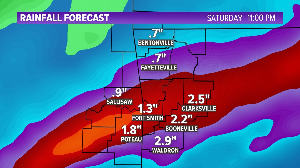
Flood Watch (1-4+ inches): Carroll, Crawford, Madison, Franklin, Johnson, Le Flore (OK), Logan, Scott, Sebastian, and Sequoyah (OK) counties.
In Arkansas and Oklahoma, we'll stay on the warm side with rain and storms New Year's Eve night (Friday) into New Year's Day (Saturday). Temperatures are likely to stay in the 50s overnight into Saturday morning. The cold front will arrive Saturday afternoon, quickly dropping temperatures below freezing with wind chills in the single digits to near zero. Air temperatures will eventually drop into the teens.
What about snow? (scroll down to the bottom for more details) Flurries are possible as clouds lower across Arkansas and Oklahoma Saturday evening. Accumulation chances look slim. Ground temperatures are warm. Some flash freezing could occur on bridges and overpasses with the cold temperatures Saturday night into Sunday morning.
Tap HERE to track the storms with our live interactive radar.
TIMING OUT THE STORM

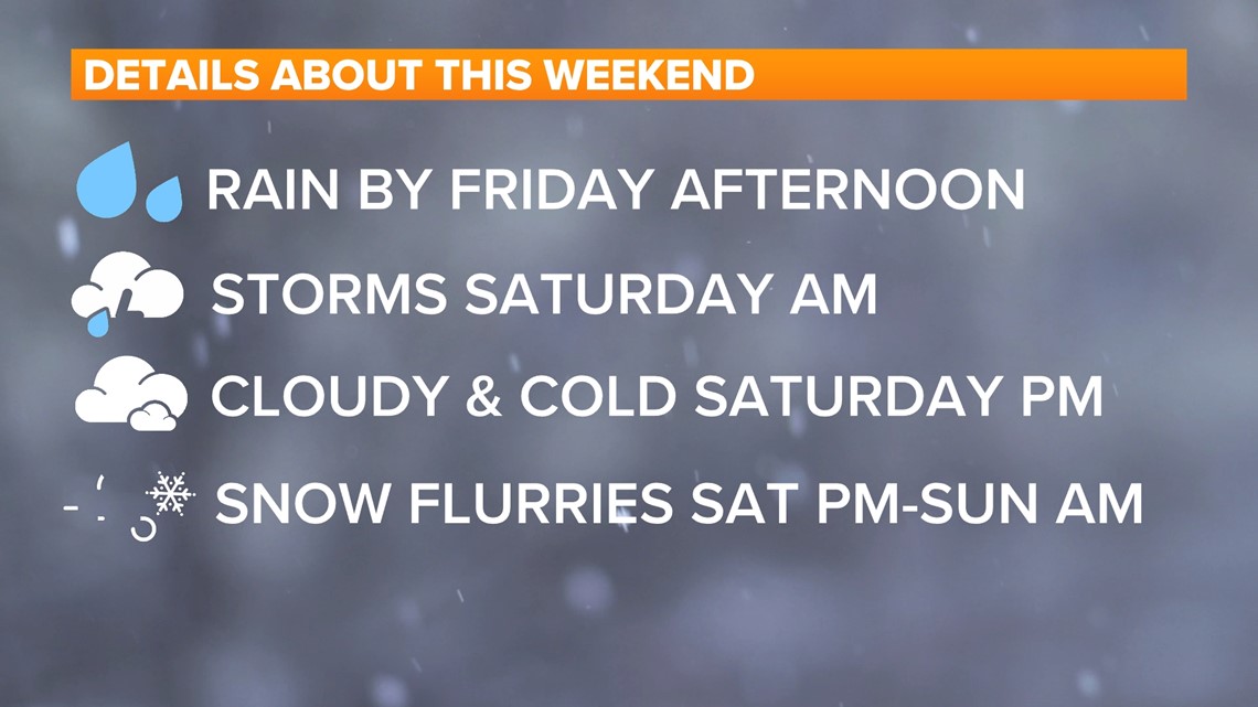
FRI Evening - Midnight: Scattered showers, 60s
SAT Midnight - 4 AM: Heavy rain & storms, 50s
SAT 4 AM - 10 AM: Scattered showers, 50s
SAT 10 AM - 4 PM: Mostly cloudy, drizzle, 40s
SAT 4 PM - 9 PM: Cloudy, flurries, 20s/30s
SAT 9 PM - SUN 6 AM: Cloudy, flurries, teens (wind chills near zero)
SUNDAY: Clearing skies with 30s
SEVERE CHANCES FRIDAY NIGHT / EARLY SATURDAY

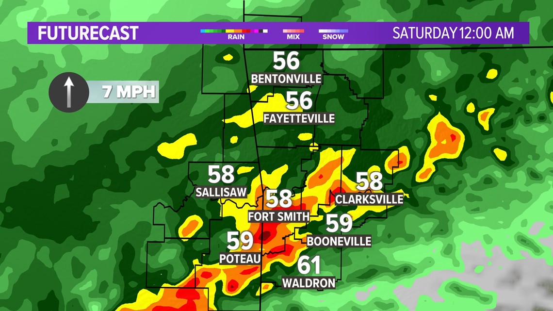
Storms are likely as midnight arrives with 2022. The strongest storms will be in the River Valley. The main risks include:
- Heavy rain & lightning
- Gusty winds
- Low tornado threat
Northwest Arkansas will mainly get moderate-heavy rain. The heaviest rain will be in the River Valley, south of I-40.

THEN IT GETS COLD...
Temperatures will drop quickly Saturday afternoon to below freezing. Wind chills are likely to drop to near zero Saturday night as gusts could top around 30 MPH out of the northwest.

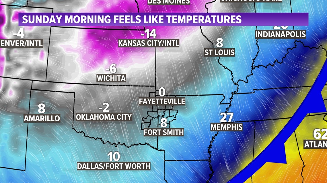
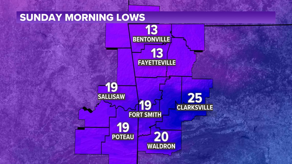
Waking up Sunday morning... western Arkansas and eastern Oklahoma will be in the teens.

WILL IT SNOW?
The heavy snow will stay north. Arkansas and Oklahoma will not be picking up inches of powder out of this snowstorm. Temperatures will be too warm for the duration of this event. However as clouds lower on Saturday afternoon, be on the lookout for some flurries area-wide. Most likely there will not be much accumulation. A few of us may briefly watch some flakes stick to grassy surfaces and a mailbox or two. Ground temperatures are very warm so we'll have to wait and see.

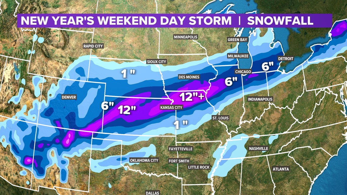
With temperatures dropping below 20 degrees for much of Saturday night, there may be some flash freezing on bridges and overpasses. Look out for black ice Sunday morning. There may be some slick spots. Also, it may be a good idea to let the water trickle out of faucets Saturday night to reduce the threat of bursting pipes. Let the water run so the stream is about as wide as the lead inside a #2 pencil.
-5NEWS Weather
Tonight's Forecast

